Mountain Bike Trails
Doña Ana Mountains Trail System
These are the premier mountain biking trails in the Las Cruces area, with miles and miles of trails ranging from beginner or even kid friendly to quite challenging and rocky terrain for experts. It is also the home of the Horny Toad Hustle, our signature fall MTB race, and usually the best attended in the state (sponsored by Outdoor Adventures, of course).
There are four commonly used trailheads, but the below directions will take you to the most popular one (by far). North of the trailhead, the trails will split into different directions. We are hoping to incorporate maps into our website at some point, but it should be nearly impossible to get lost since the terrain slopes upward as you go north, and it's fairly easy to look back towards the parking area.
Directions: Take I-25 to the Doña Ana Exit (#9) and head east up the hill to the Stop sign by Ben Archer Health Center. Turn left (North) and then immediately right onto Calle de Las Lomas. Make a left on La Reina, then take the first right on Desert Wind Way. Road will turn to dirt, cross cattleguard and 1.9 miles after the turn, the BLM parking area will be on the left (north) side of the road. You will likely will find other bikers there who will gladly give you trail information.
Tortugas "A" Mountain
A fun and somewhat challenging single/doubletrack around Tortugas "A" Mountain, the mountain with the obvious "A" on it, east of I-25 and south of University Avenue. The perimeter trail is approximately 4 miles around and includes some of the most difficult sections in the area--along with alternate paths for those feeling less adventurous. There are also a number of side trails that divert from the main loop; there is plenty to explore at this easy-to-access loop located five minutes from the freeway.
Directions: Take University Avenue east of the I-25 intersection (Exit 1) until "A" Mountain is on your right. Once you reach the north side of the mountain, there are two areas to park: The most popular of the two being the second one you'll pass, which is on the northeast side of the mountain as you continue east. The first parking area is not adjacent to the trail, so starting there can be a bit confusing if you're new to the area.
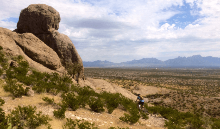
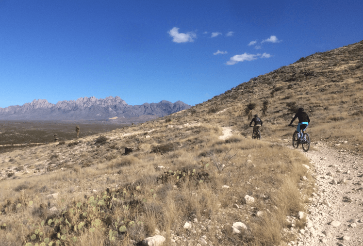
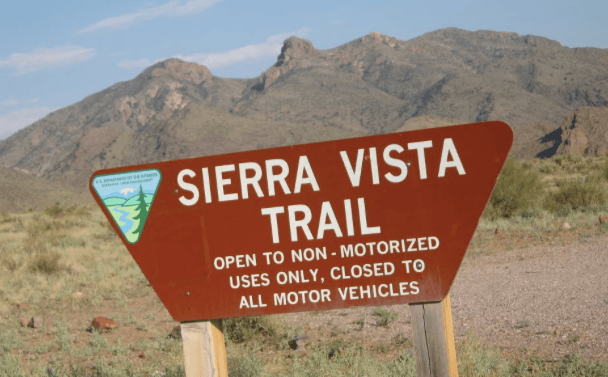
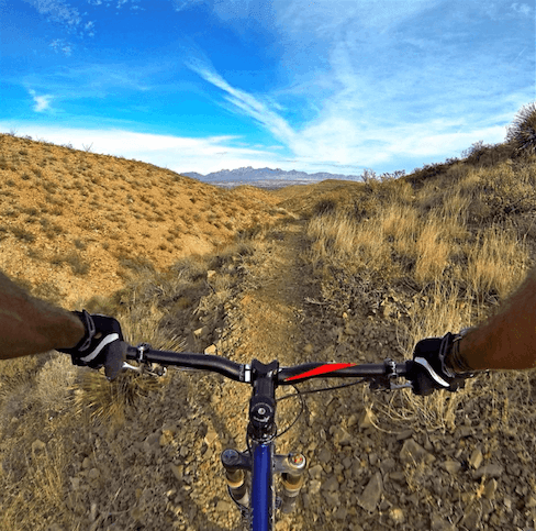
Sierra Vista Trail
A lovely desert ride which can be ridden either north or south from the trailhead. Going south, it meanders about 10 miles, generally downhill, finally reaching a dirt road near Bishop's Cap The trail actually continues past that point but becomes quite sandy in a few more miles. Most people ride back up by the same route, but if you're making a loop from Las Cruces, you can turn right on the dirt road and in a few miles drop down to the Interstate frontage road near Mesquite.
From the same trailhead, if you head north, you will be treated to a short but really pretty and well designed singletrack, which will ultimately deliver you to Dripping Springs Road (about 2.8 miles). Completed in the fall of 2011, a lot of it is smooth & fast. Return by the same route or make a loop from below the Soledad Canyon Rd / Dripping Springs Rd intersection.
Directions: Take University east of the I-25 intersection (Exit 1). Turn east toward the Organ Mountains and follow the paved road. There will be a right turn onto Soledad Canyon Road and a left turn at a fire station (just before the road turns to dirt). About 3 miles after the fire station, there will be a big, wooden BLM trail sign on the right side of the road indicating the trailhead. If you see Ladera Canyon Road on your right, you've gone too far.
Robledo Mountains "SST Trail"
According to the BLM website, "the mountain bike trail is an extremely technical trail -- traversing challenging rocky terrain, steep canyons, and mountain-top ridges -- and requires expert riding skills."
Directions: The Robledo trail is reached from a road called Shalem Colony Trail; directions to this road are provided below:
From Las Cruces take Valley Drive (185) north to Shalem Colony Trail and turn left. Follow Shalem Colony until you cross the river and turn right on Rocky Acres Trail, which should be the first right after the river. If you pass the two water tanks up a hill on your right, you have gone too far.
From El Paso (I-10 west) or Deming (I-10 east) take I-10 to the Picacho exit and go east on Picacho. When you see Guacamole's restaurant on your right, Shalem Colony Trail is on your left. If you reach the Pic Quic in Fairacres on your left, you have gone too far. Follow Shalem Colony for a few miles until you pass 2 tall water tanks on a hill on your left side. If you cross the river, you have gone too far. Soon after the water tanks there will be a road on your left called Rocky Acres Trail.